| We strongly recommend newcomers hire a local guide familiar with the
area and with mountaineering experience and skill in snow and ice climbing.
To make the trip more enjoyable, it is also recommended hiring porters
or pack animals to haul gear. Guides and services are available in Pinedale,
Jackson Hole and Dubois. Contact the Dubois and Pinedale Ranger District
Forest Service offices for a list of legal licensed guides.
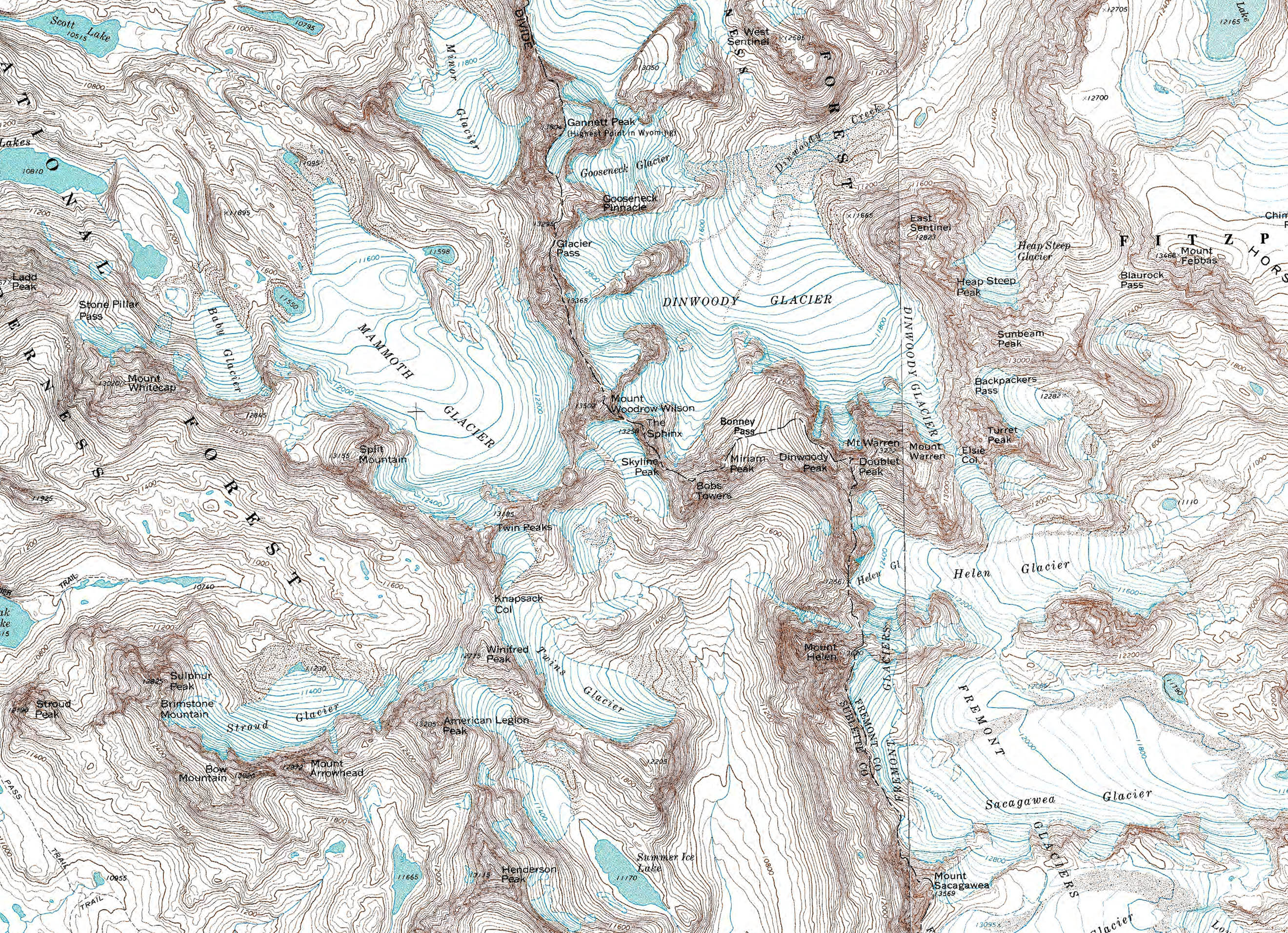
Location
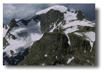
Gannet Peak is located in the northern Wind
River Mountain Range on the Continental Divide (in both the Fitzpatrick
and Bridger Wilderness Areas), in west-central Wyoming (Fremont & Sublette
Counties). 25 miles north-northeast of Pinedale. Looking at a map of the
Wind River Mountains, locate Green River Lakes and New Fork Lakes north
of Pinedale. Split the difference between the two lakes and go east approximately
10 air miles until you hit the Continental Divide and you'll see Gannet
Peak. Latitude: 43 degrees 11 minutes N. Longitude: 109 degrees, 39 minutes
W. USGS Maps: Gannett Peak, Bridger Lakes, Fayette Lake, Fremont Lake North,
Fremont Peak North, Ink Wells, Torrey Lake, Hays Park - 7.5 Minutes
Weather
Summer days are typically warm and dry during
the day, (70s-80s) with late-day thunderstorms with rain. Sub-freezing
nighttime temperatures are not uncommon. Be prepared for high winds
and rapidly changing weather conditions. Mountain snowstorms can
occur any day of the year in the Rocky Mountains. Adequate clothing
is a must, along with sunscreen, mosquito repellent, and water filtration
equipment. Mosquitos can be fierce during the summer, but are usually
gone by September. A mosquito headnet is useful. Sleeping bags should be
rated to -15 degrees. Be sure to bring lip balm, sunglasses with UV protection,
insect repellent, warm socks & hat, gloves, rain gear, adequate shoes,
water purification equipment, snack food, camera/film, and fishing gear!
Check with the local Forest Service office before heading out to get
current trail conditions and advisories for the area.
Other Web Information:
Highpointers
Club
Bridger-Teton National
Forest
Peakware
World Mountain Encyclopedia Wind River Range Page
Topographic Maps:
Gannett Peak, Wyo., 7 1/2 minute
Bridger Lakes, Wyo., 7 1/2 minute
Fayette Lake, Wyo., 7 1/2 minute
Fremont Lake North, Wyo., 7 1/2 minute
Fremont Peak North, Wyo., 7 1/2 minute
Ink Wells, Wyo., 7 1/2 minute
Torrey Lake, Wyo., 7 1/2 minute
Hays Park, Wyo., 7 1/2 minute
Other Good Maps:
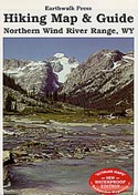
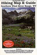
Eathwalk Press Maps, Wind River Range North & South Trail
Maps,
Scale: 1: 48,000; topographic, available in paper or waterproof versions
North map covers Elkhart Park to Union Pass, South covers covers Elkhart
Park to Big Sandy.
Order Maps Online:
Grand Teton Natural
History Association
Books:
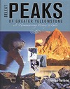 Select Peaks of Greater Yellowstone,
by Thomas Turiano, Indomitus Books, 2003 (Complete and current guide and history
to mountaineering on Gannett
Peak and 106 other major peaks in the Greater Yellowstone region. Purchase
online at www.SelectPeaks.com) Select Peaks of Greater Yellowstone,
by Thomas Turiano, Indomitus Books, 2003 (Complete and current guide and history
to mountaineering on Gannett
Peak and 106 other major peaks in the Greater Yellowstone region. Purchase
online at www.SelectPeaks.com)
Wyoming's Wind River Range, by Joe Kelsey, American Geographic
Publishing, 1988 (a pictorial treatment of the geology, history and nature
of the range, packed with information)
Day Hiking the Wind River Range, by Tom Carter. Soft-cover. 88
pages. This small volume covers 14 day hikes in the Wind River Mountains.
Featuring trail descriptions, history, geology and plant and wildlife info.
Rates each trail's difficulty and hiking times and provides elevation profile
charts. All this in a pocket-sized book. Portions of the book's photos
were taken by Dick Du Mais, local Wilson, Wyoming resident.
Climbing and Hiking in the Wind River Mountains, by Joe Kelsey,
Sierra Club Books, 1980 (the definitive guide for serious climbers, focuses
on specific climbing routes for the major mountains)
Hiking Wyoming's Wind River Range, by Ron Adkison, Falcon Press,
1996 (A modern hiking guide, including fishing information. Includes most
of the wilderness trails with elevation charts and difficulty ratings.
The cover photo was taken by Pinedale's own Fred Pflughoft.)
Walking the Winds-Hiking and Fishing Guide to Wyoming's Wind River
Range, by Rebecca Woods, White Willow Publishing, 1994 (A hiking guide
with excellent fishing info, divided into short, medium and backpack trips
from each trailhead. With photos and maps.)
Wind River Trails, by Finis Mitchell, Wasatch Publishers, 1975
(The classic Wind River hiking, climbing and fishing pocket guide, written
by the famous local master of the Winds. Photos, maps and interesting text.
Excellent backpacker's reference, although a bit outdated now.)
The Wind River Range, Field Book by Orrin and Lorraine Bonney
Climbers Comments:
8/99 Lance Anderson: Climbed Gannett in 12 hours (round trip),
solo. 65 degrees on top, totally calm, warm, "amazing". A couple
of small snowfields on the way to Titcomb Lakes, then 80% snow travel with
ice axe and crampons. Lots of snowmelt water coming off everywhere. Lots
of people camping in Titcomb Basin. "Was slower and steeper than
I expected."
7/97 Gary Jensen: "This was a challenging, awe inspiring hike
and climb. We filtered all water from snowmelt and springs, and hung bear
bags with religious zeal (never saw a bear)...We heard that the snow bridge
across the bergshrund glacier collapsed two weeks later. The unbelayed
climber who was on it was seriously injured, and had to be evacuated by
horseback. I'll do this hike/climb again in a few years. It was well worth
the work." Excerpts from trip diary by Gary Jensen on http://www.americasroof.com/wy.html
1/97 Scott Brumund: "...The lower 1/3 of the trial is mixed
snow and rock and the upper 2/3 all steep snow. When we reached the steep
section, we put on our crampons. It was a long strenuous 1000' climb to
the top of Bonney Pass at 12,850'...Though I felt very good and was thankful
for the extra day at altitude the rest of our group did not look so good.
My son Ryan in particular was shivering and looked particularly miserable.
I was thinking that none of us would make it to the top but kept my mouth
shut and hoped for the best. At the top of the pass there were several
tent sites surrounded by stone walls to protect them from high winds. If
I took this route again, I would plan to camp at the top of the pass and
not in the basin...Our bottles were filled from water running directly
off the glacier, the best water of the trip...I remember thinking as I
looked down on the Mirror glacier "what am I doing here" when
we reached the top all such thoughts left my mind. We had a view of five
active glaciers we could see the Teton range to the northwest and the Bighorn
range to the north. We were surrounded by peaks and ranges which we could
not identify... The highlight of the decent was a steep 200' down climb
followed by crossing a berchsrung (a type of crevasse) on a snow bridge
and a glissade (sit on you butt and slide) down to the basin below. Now
we were faced with the hardest part of the trip the climb back up to Bonney
pass and the descent to our camp in the Titcomb basin. It was 11:30 p.m.
before we regained the pass. We descended the pass in darkness with headlamps
and reached camp at 1:00 a.m. The climb of Gannet peak took 20 hours, we
ascended 5,050 vertical feet over 2 ½ horizontal miles, crossing
two active glaciers mostly on snow and ice roped together in teams of two
and three." Excerpts from trip diary by Scott Brumund http://vagor.resnet.mtu.edu/high/gannet.htm
Do you have comments about climbing Gannett? E-mail us! support@pinedaleonline.com
|