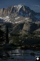
Wind River Range condition update
Fires, trails, bears, Continental Divide
by Dawn Ballou
July 27, 2005
Here’s the latest update on conditions in the Wind River Mountain Range and Bridger Wilderness, as of Wednesday, July 27th, gleaned from reports from the Bridger-Teton National Forest (BTNF) staff.
Mountain Passes & the Continental Divide:
The snow is mostly off now up to the Continental Divide. There still are some locations with snow above about 11,000 feet, depending on aspect and micro-conditions. Jackass Pass over the Cirque of the Towers is passable and people have been up rock climbing the Cirque. Bonny Pass to Gannett Peak still has some snow. Night-time temperatures in the high country can be cold.
Group Trips:
Groups venturing into the wilderness area are reminded they need to fill out a free group permit from the local Forest Service office before going into the backcountry. This applies to church groups, scouts, clubs, etc. planning group day and overnight trips into the wilderness. Group size is limited to 15 individuals and 25 stock animals. Trip permit applications should be filled out and returned to the Pinedale Ranger District 15 days prior to your scheduled departure date.
Trails:
The Forest Service trail crews have cleared all the trails they planned to clear. There was a lot of blowdown on trails from wind and winter snow. Hikers may still encounter some downfall on lesser traveled trails back in the wilderness, even on trails that were cleared, as new trees occasionally still fall over time. Pick campsites carefully and avoid areas with trees that may be dead or weakened by beetle kill, which may be susceptible to falling down in windstorms. Water crossings should be at normal levels now that spring snowmelt high water is over. All the trailhead corrals are back up now, including New Fork Lakes. Everyplace that usually has potable water service now has water on in developed campgrounds and at trailheads.
Wildfires:
The only wildfire presently burning on the Pinedale Ranger District is the Tourist Creek fire about 10 miles southeast of Green River Lakes. This small fire started Thursday, July 21st, and is burning in rocky, rugged terrain with sparse fuels. Forest Service crews were doing a reconnaissance flight on the forest today, Wednesday, to check out that fire and look for any new starts from the lightning we had earlier this week. The word from the Forest Service today was if they didn’t see smoke from the Tourist Creek fire from the aerial check, they would lift the closure that has been in effect for that drainage. This closure does not affect the main Green River Lakes trails, access to the Continental Divide National Scenic Trail or Square Top Mountain. The Green River Lakes trailhead and campground remain open despite this small fire. Fire danger remains Moderate with no campfire restrictions in place on the BTNF. As always, be careful with campfires and never leave one unattended.
Bears:
No reports of bear sightings for either griz or black bears. Backcountry users should always be “bear aware”, carry fresh cans of pepper spray, and follow food storage regulations. Grizzly and black bear are abundant in the Wind River Mountains, Bridger Wilderness, Gros Ventre Wilderness and Wyoming mountain ranges. The Forest Service has bear-proof containers available for rent for a nominal fee at the local District offices.
Bugs:
Mosquitoes have died down a bit and biting bugs seem to be a little less voracious with the colder nights. Be sure to bring long-sleeve shirts, long pants and plenty of bug spray. Those who wish to hike in shorts and tank tops should be prepared to deal with biting horseflies, no-see-ums and mosquitos. Some folks hike with mosquito netting hanging from hats and clothing covering exposed skin from head to toe and others make sure they have several cans of something with DEET. Don’t forget to bring something to keep the biting bugs off your pack animals.
Fishing:
Reports we hear are that the fishing is great!
Road Conditions:
The road crews usually do a spring and fall blading on the main dirt roads, so we’re kind of inbetween that right now. The Green River Lakes road is getting a bit washboarded again. Road crews are scheduled to be in there again to redo that road in the next couple of weeks. What is a washboarded road? It’s when traffic creates a repeat bumpy pattern on a dirt/gravel road similar to those old fashioned washboards for doing laundry. If you drive too fast on one, you can find yourself bounced right off the side of the road quite suddenly. As with any gravel road, just slow down and take it easy. Travel speeds are best in the range of 35-45 mph, depending on the conditions. Some roads have a posted speed limit. Watch for wildlife, and ATVs, which also use the roads.
ATVs and ORVs:
There are lots of great places to go and things to see with your 4-wheeler or off-road vehicle. The only word here is to make sure you pick up a travel map from the local Forest Service office to make sure you stay on designated routes. The maps are free and show where it’s ok to ride and which roads/trails are closed for ORV use.
More Info:
The local Forest Service District offices in Pinedale and Big Piney can provide current local information and maps for the Bridger-Teton National Forest. The Sublette County Chamber of Commerce office in Pinedale also has area information, a variety of free maps and local business information about lodging-dining-shopping and local guide services.
Related Links:
Food Storage Order for Bridger-Teton National Forest
Bridger Wilderness Permits and Info
Bridger-Teton National Forest
Climbing Wyoming New climbing website by local climber Wes Gooch
Sublette County Chamber of Commerce Local info, businesses & services
|
