Green River near LaBarge
The Green River one mile north of LaBarge on Sunday, June 26th. Photo by Alexandra Heil.
|
Pine Creek high flow
Water flowing out of Fremont Lake into Pine Creek on Saturday, June 25th. Photo by David Rule.
|
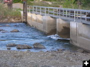
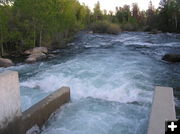
Fremont Lake Dam
Upstream view of Fremont Lake Dam for Pine Creek on Saturday, June 25th. Photo by David Rule.
|
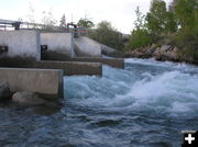
Fremont Lake Dam - downstream
Downstream view of flow from the Fremont Lake Dam into Pine Creek on Saturday, June 25th. Picture by David Rule.
|
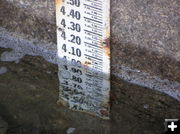
Fremont Lake dam gauge
Gauge showing the water level of Fremont Lake at the outlet dam on Saturday, June 25th. Photo by David Rule.
|
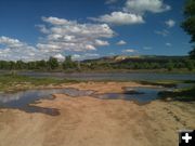
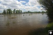
Green River
Green River flowing south where it crosses US 189 just north of Daniel. Photo taken Sunday afternoon, June 26th. Photo by Dawn Ballou, Pinedale Online!
|
Horse Creek
Horse Creek, looking downstream, at the crossing with US 189 just south of Daniel on Sunday afternoon, June 26th. Photo by Dawn Ballou, Pinedale Online!
|
Horse Creek near Daniel
Horse Creek south of Daniel at crossing with US 189 on Sunday afternoon, June 26th. Photo by Dawn Ballou, Pinedale Online!
|
Horse Creek upstream
View looking upstream Horse Creek at its crossing with US 189 just south of Daniel on Sunday afternoon, June 26th. Photo by Clint Gilchrist, Pinedale Online!
|
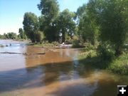
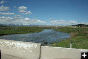
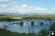
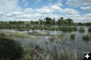
New Fork River
New Fork River
The New Fork River is near full bank just north of Hwy 351 east of Paradise Road and the BLM boat access area. Note that upstream irrigators are pulling water out of the river, removing some of the high water flows that would otherwise be going downstream. Photo taken Saturday, June 24th, by Clint Gilchrist, Pinedale Online!
|
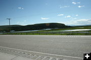
New Fork Hwy 351 bridge
View of the New Fork River just above the Hwy 351 bridge on Saturday, June 25th. Photo by Dawn Ballou, Pinedale Online!
|
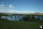
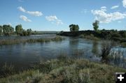
New Fork River - June 25
New Fork River overflow at the new historic park north of Hwy 351 on Saturday, June 25th. These are similar river conditions to what Lander Trail/Oregon Trail emigrants would have encountered when crossing the New Fork in late June in the mid-1800s, resulting in drownings, overturned wagons, and loss of livestock in the high water during the dangerous crossing. Photo by Dawn Ballou, Pinedale Online!
|