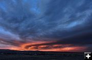

Cold front
Local photographer Dave Bell captured the change in the weather with the winter cold front. Click here for more pictures.
|
|
Cold front brings snow to Wyoming
by National Weather Service
November 12, 2012
A winter storm has brought the first significant snow of the season across western and central Wyoming. Precipitation from the storm began as rain and impacted western portions early Friday morning, before changing over to snow. Rain then spread eastward during the day on Friday and had a mix of freezing rain and snow by Friday evening. The following are final storm totals from this event.
LOCATION - SNOWFALL
Sublette County
Big Sandy Opening SNOTEL, 13 Inches
Larsen Creek SNOTEL, 9 Inches
Elkhart Park G.S. SNOTEL, 8 Inches
Gunsite Pass SNOTEL, 8 Inches
Kendall Ranger Station SNOTEL , 7 Inches
Pocket Creek SNOTEL , 6 Inches
East Rim Divide SNOTEL , 6 Inches
Loomis Park SNOTEL, 4 Inches
New Fork Lake SNOTEL, 4 Inches
Triple Peak SNOTEL, 4 Inches
Snider Basin SNOTEL , 2 Inches
Boulder, 2 Inches
Daniel, 2 Inches
14 NW Pinedale, 1.8 Inches
Sweetwater County
38 NW Superior, 6.1 Inches
Green River, 5-6 Inches
5 N Farson, 4.5 Inches
1 W Rock Springs, 3.5 Inches
1 E Rock Springs, 3.4 Inches
Buckboard Marina, 3 Inches
2 W Rock Springs, 1.5 Inches
Rock Springs, 1.5 Inches
Teton County
Grand Targhee Ski Area, 17 Inches
Grand Targhee-Chief Joseph, 17 Inches
Togwotee Mountain Lodge, 11 Inches
Grand Targhee SNOTEL, 10 Inches
Grassy Lake SNOTEL, 10 Inches
Togwotee Pass SNOTEL, 8 Inches
Base Camp SNOTEL, 7 Inches
Gros Ventre Summit SNOTEL, 6 Inches
Jackson Hole-Rendezvous Bowl, 4 Inches
5 NW Jackson, 3.5 Inches
Jackson Hole-Raymer, 3 Inches
Moose, 2 Inches
12 NE Jackson, 2 Inches
Snow King Ski Area, 2 Inches
Jackson, 1.8 Inches
4 SSW Jackson, 1.1 Inches
Yellowstone National Park
Sylvan Lake SNOTEL, 16 Inches
Two Ocean Plateau SNOTEL, 12 Inches
Parker Peak SNOTEL, 9 Inches
Tower Falls Ranger Station, 4.5 Inches
Sylvan Road SNOTEL, 4 Inches
Old Faithful Ranger Station, 1 Inch
Canyon SNOTEL , 1 Inch
Lewis Lake Divide SNOTEL, 1 Inch
Lincoln County
3 SE Bedford, 20 Inches
5 NNE Thayne, 14.5 Inches
2 SE Thayne, 12.7 Inches
Willow Creek SNOTEL, 12 Inches
Afton, 6-11.2 Inches
5 SSE Smoot, 9 Inches
1 W Smoot, 8 Inches
Blind Bull Summit, 7 Inches
Fairview, 7 Inches
Salt River Summit SNOTEL, 6 Inches
Cottonwood Creek SNOTEL, 6 Inches
Blind Bull Summit SNOTEL, 4 Inches
Kelley Ranger Station SNOTEL, 4 Inches
Indian Creek SNOTEL, 4 Inches
Alpine, 3 Inches
Hams Fork SNOTEL, 3 Inches
Box Y Ranch, 2 Inches
Spring Creek Divide SNOTEL, 1 Inch
Kemmerer, 1 Inch
Hot Springs County
1 SW Thermopolis, 6-9.5 Inches
Owl Creek SNOTEL, 8 Inches
9 NE Thermopolis, 6.9 Inches
Thermopolis, 5-6 Inches
Kirby, 5.5 Inches
Fremont County
Deer Park SNOTEL , 17 Inches
South Pass SNOTEL, 11 Inches
Hobbs Park SNOTEL, 10 Inches
Castle Creek SNOTEL, 10 Inches
Brooks Lake Lodge, 9 Inches
Cold Springs SNOTEL, 7 Inches
Burroughs Creek SNOTEL, 7 Inches
Little Warm SNOTEL, 7 Inches
31 WSW Thermopolis, 5.3 Inches
6 SW Lander, 5.1 Inches
Townsend Creek SNOTEL, 5 Inches
Burris, 5 Inches
Dubois, 1-4.5 Inches
9.5 SW Lander, 4 Inches
St. Lawrence Alt SNOTEL, 4 Inches
Lander Airport, 3.6 Inches
10 WNW Dubois, 3.5 Inches
3 Sw Lander, 3.5 Inches
1 W Lander, 3.3 Inches
6.6 SW Lander, 3 Inches
Riverton, 2.9 Inches
10 NNE Riverton, 2.5 Inches
Boysen Dam, 1.5 Inches
6 SE Lander, 1 Inch
Jeffrey City, 1 Inch
Riverton Asos, 0.9 Inches
|
