
Funnel cloud or tornado
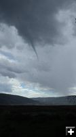
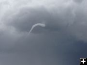
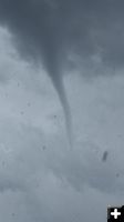
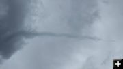
Follow the bottom line of the funnel and it can be seen on the ground at the lake. Photo by Kathy Raper.
|


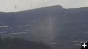
Picking up water
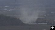
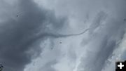
The water lift is higher than the trees around the lake. Photo by Kathy Raper.
|
|
Funnel cloud spotted near Green River Lakes
Photos by Amy Hemenway and Kathy Raper
June 6, 2014
Amy Hemenway and Kathy Raper sent in images of a funnel cloud seen on Saturday, May 31st. Amy, her husband and three daughters were on their way up to fish at Green River Lakes.
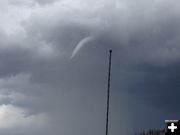
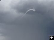
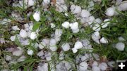
Kathy and Charlie Raper were 4-wheeling up just north of The Bend on the Green River and got caught in the hail storm and saw the funnel cloud from the opposite direction. Kathy watched and took pictures of the funnel touching the ground at what she thinks was Dollar Lake and watching water being sucked up higher than tree level. The hail that came down was dime to penny size. The event transpired around 3PM on Saturday, May 31st. "While Rangering in the upper Green today (Saturday, May 31, 2014), it started hailing hard. We parked in the trees on the bench above The Bend trying to avoid the dime size (and bigger) hail. Then we spotted this in the sky. When we first saw the funnel it was down the river towards Dollar Lake. We could see water being sucked up out of the lake and then red dirt flying. We watched as the funnel moved directly above us."
Funnel clouds and tornadoes are rare events in the Upper Green River Valley, however thunderstorms are common in the summer months and can bring strong downburst winds along with intense lightning and hail.
___________________________
From the National Weather Service:
*EXCITING NEWS - NEW WORLD RECORD*
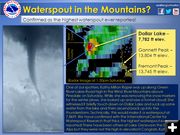
The International Centre For Waterspout Research has confirmed that this is the highest elevation waterspout on record! There have been others in the Swiss Alps over Lake Geneva (elev: 372 m (1,220 ft)) but they were not higher than this. Congratulations, Kathy Milton Raper on your rare find!
**************************************
Something pretty interesting happened yesterday: One of our spotters was up in the Wind Rivers removing snow markers for the winter plows when suddenly she witnessed a tornado touch down briefly on Dollar Lake, suck up some water, and ascend back into the cloud; by definition, this is a waterspout! She was able to bring out her camera and snap this photo once it ascended. The darker streaks you see in the foreground are hail.
We were able to pull up the radar data at the time and unfortunately, the velocity data (the radar data that shows us whether or not a storm is rotating) was what is called "range folded" or the radar is unable to detect the movement in the storm. However, we were able to see that there was a storm there based on the reflectivity data, the lightning data also showed a few strikes at the time.
So far in our research, we have not been able to find any information on waterspouts in the mountains. The International Centre For Waterspout Research has confirmed that this is the highest on record! There are many reports of waterspouts on the Great Lakes and over the ocean, at or close to sea level so this is indeed a very rare event! Our thanks to Kathy Milton Raper for reporting this to us and sending in the pictures!
|
